Ten Lakes: Why Glacial Floods Come Without Warning
15 million people live in the path of glacial lake floods. About ten Himalayan lakes have been properly studied. Here's why the warning never comes.

What a glacial lake outburst flood is, why the Himalaya is the most exposed place on earth, and why the warning does not come
The thing that kills people is that it does not rain first.
Every warning system ever built for flooding in a mountain region watches the weather. Rain gauges, forecasts, river levels, the accumulated experience of everyone who has ever lived in a valley and learned what the sky looks like before the water rises. That knowledge is real, it is generations deep, and it works.
It does not work for this.
A glacial lake outburst flood does not need rain. It does not need a storm, or a monsoon, or any warning in the sky at all. It can arrive on a clear morning, in bright sun, into a valley where nobody has any reason to look up, and by the time anyone downstream understands what is happening, the thing has been moving for several minutes at the speed of a collapsing mountainside.
This piece is about what that hazard actually is, how many people are standing underneath it, and why almost nobody is watching the places it comes from.
What is actually happening up there
Start with the mechanism, because it is simple and almost nobody knows it.
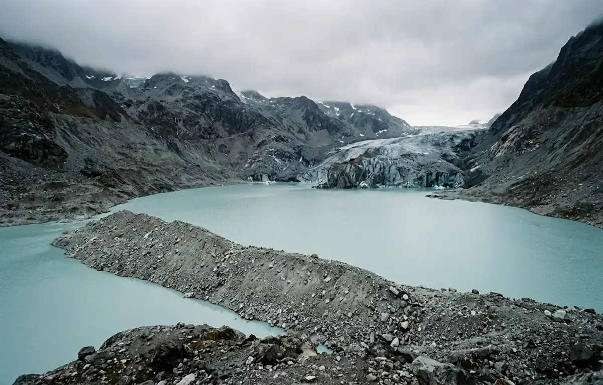
A glacier melts. It has always melted a little; now it melts a great deal more. The meltwater collects at the glacier's lower end, and it is held in place by whatever the glacier left behind when it retreated, usually a moraine, which is a wall of loose rock and gravel and ice, deposited over centuries by the glacier's own grinding movement.
That wall was never engineered. It is a heap of debris that happens to be holding back a lake.
Behind it, the lake grows. As the glacier retreats further and melts faster, the lake gets deeper and heavier and pushes harder against a dam made of rubble.
Then something triggers it. A piece of ice or rock falls into the lake from above and displaces the water in a single wave. An earthquake shakes the moraine. Water seeping through the debris finally carries away enough of it. The dam gives, and the entire lake, which may hold millions of cubic metres, leaves at once.
What comes down the valley is not water. It is water carrying rock, boulders, mud, ice, trees and everything else it collects on the way, a moving mass with the density of wet concrete. It can travel more than a hundred and twenty kilometres from where it started. People a hundred kilometres downstream, in a completely different landscape, in another country, can be killed by a lake they have never heard of failing on a mountain they cannot see.
That is a glacial lake outburst flood. The literature calls it a GLOF, which is an ugly acronym for one of the most frightening things the physical world produces.
•••
How many people are standing under it
The first global assessment of who is actually exposed was published in 2023 by an international team led by Newcastle University, and its numbers are worth stating precisely.
Ninety million people, across thirty countries, live in the 1,089 river basins that contain glacial lakes.
Of those, fifteen million live within fifty kilometres of a glacial lake and within one kilometre of a potential flood path. That is the exposed population: fifteen million people whose homes sit in the way.
Sixty-two per cent of them, around 9.3 million, are in High Mountain Asia. Roughly a million people live within ten kilometres of a glacial lake.
And more than half of the entire globally exposed population is concentrated in just four countries: India, Pakistan, Peru and China.
That last fact is worth sitting with, because it disposes of any notion that this is an obscure hazard affecting a handful of remote villages. It is a threat to a population the size of a mid-sized European country, concentrated in four of the poorer and more populous nations on earth, two of which barely speak to each other.
The researchers also flagged the Andes as a region of comparable exposure to High Mountain Asia which has attracted far fewer studies, meaning the danger there is roughly as large and considerably less understood.
•••
It is getting worse, and this part is not disputed
The Himalaya has recorded an average of 1.3 glacial lake outburst floods per year since the 1980s.
Nepal alone has experienced twenty-six of them since the 1970s. Forty-seven Nepali glacial lakes are currently classified as potentially dangerous. Economic losses from a single event can exceed a hundred million US dollars, before anyone counts the dead.
And the hazard is growing for a reason that requires no modelling to understand: as glaciers retreat, more lakes form, and existing lakes get bigger. Modelling of future lake expansion suggests exposure could rise by more than twenty-seven per cent at high-risk lakes, and by more than forty per cent in the Himalayan regions outside China.
Nothing about that is contested. It is the direct arithmetic of ice becoming water in a place where the water has nowhere to go but down a valley with people in it.
•••
Ten lakes
Here is the number this piece is named for, and it is the one that should be difficult to read.
There are thousands of glacial lakes across the Himalaya. A 2025 assessment in the Bulletin of the American Meteorological Society records that only about ten Himalayan glacial lakes with historically recorded outburst floods have been investigated in the field over an extended period.
Ten.
Not ten monitored in real time, ten that have been studied properly on the ground, over time, out of thousands, in the mountain range where nine million people live in the path of the water.
The same paper proposes a benchmark monitoring network for the region, combining ground instruments, satellite observation and hydrodynamic modelling, feeding into early warning.
Proposes. As in: it does not exist. As in: the comprehensive system that would tell a village in a valley that a lake forty kilometres above them has just failed is, at the time of writing, a diagram in a scientific journal.
There are exceptions, and they matter. Nepal has a Green Climate Fund project worth thirty-six million dollars to lower water levels at four priority lakes, Thulagi, Lower Barun, Lumding Tsho and Hongu 2, and to install early warning systems. China has done substantial engineering work on lakes inside its territory. Individual lakes have been reinforced with real success.
But hold the shape of that. Thirty-six million dollars, to make four lakes safer, in a country with forty-seven dangerous ones, and it is genuinely good news that somebody funded it.
•••
The water crosses the border. The warning has to as well.
There is a second problem, and it is political rather than technical.
Glaciers do not sit inside jurisdictions. A lake can be on one side of a national boundary and the people it will kill on the other. The flood begins in one country and arrives, minutes or hours later, in a village governed by a different one.
Which means an effective warning system is not a piece of equipment. It is an agreement, a standing arrangement in which one state's monitoring instrument automatically triggers an alert in another state's valley, at three in the morning, without anyone needing to make a phone call or seek approval or consider the diplomatic implications.
The academic literature notes this with careful understatement: the transboundary nature of these floods complicates early warning, "particularly in politically sensitive regions."
Look at the map that description covers. India and Pakistan. India and China. Nepal and China. Bhutan and China. These are the borders across which the water travels, and they are among the least cooperative frontiers on earth.
The instrument is cheap. A water-level sensor and a radio transmitter cost very little. The obstacle has never been the sensor. The obstacle is that the sensor is on the wrong side of a line, and the people it would save are not the responsibility of anyone who could authorise it.
•••
What can be said for the other side
I want to be fair about the difficulty, because it is genuine and the people working on this are not indifferent.
These places are extraordinarily hard to reach. Glacial lakes sit at four and five thousand metres, days from the nearest road, in weather that destroys equipment and terrain that shifts. Installing and maintaining an instrument there is not a matter of ordering it. Every visit is an expedition.
The science is young. Predicting which moraine dam will fail, and when, is not a solved problem. Lakes that appear stable fail; lakes that appear precarious hold for decades. Vulnerability changes as the surrounding terrain changes. Any monitoring system would produce false alarms, and false alarms in a valley have their own costs, people who evacuate three times for nothing do not evacuate the fourth time.
And engineering cannot eliminate the hazard. The most rigorous modelling suggests that region-wide engineering measures could reduce the intensity of future floods by around twenty-four per cent. That is worth having. It is not a solution. Nobody can make these lakes safe; the best available outcome is making them somewhat less catastrophic and buying time for people to move.
All of that is true, and it is why this is a hard problem rather than a scandal.
But none of it explains the ratio.
•••
The ratio
Fifteen million people exposed. About ten lakes studied properly. A monitoring network that exists as a proposal. Thirty-six million dollars for four lakes, treated as a significant intervention.
Compare that to almost anything else. Compare it to what a single military aircraft costs, or to the annual lobbying budget of one industry, or to what a football tournament was recently valued at. The sums required here are trivial by the standards of the institutions that could supply them, and they have not been supplied for decades, while the number of lakes and the number of people beneath them both climbed.
The reason is not cost, and it is not really difficulty either.
It is that the people exposed to this hazard have almost no purchasing power, live in countries with limited capacity to fund their own systems, are distributed across borders that make coordination politically awkward, and, this is the part that decides it, contributed essentially nothing to the warming that is melting the ice above their houses.
The emissions that are destabilising those lakes were produced elsewhere, over a century, by economies that grew enormously in the process. The consequences are arriving in valleys where per-capita emissions are among the lowest measured anywhere on earth.
There is no mechanism that connects those two facts. No institution whose job is to make the party that caused the hazard pay for the instrument that would warn about it. The causation runs one way and the cost lands the other way and nothing sits in between.
•••
What this means for the next one
There will be another. The average is 1.3 a year in the Himalaya alone, and the trend is upward.
It will arrive on a day when it is not raining. It will begin at an altitude where nobody was standing, at a lake that may not have a name in any language spoken downstream. There may be a warning, if it happens near one of the small number of instrumented sites, and if the instrument is working, and if the alert can cross whatever border sits between the lake and the people.
Mostly there will not be a warning, because mostly there is no instrument.
And afterwards there will be a discussion about climate injustice, which is accurate, and which will not result in the installation of a single sensor.
It is worth knowing that the thing which would prevent most of these deaths is not a technological breakthrough or an economic transformation. It is a network of monitoring stations, an agreement to share the data across a few contested borders, and a sum of money that would not register in the budget of any state responsible for the problem.
That is all. That is the entire gap between the current situation and a much better one.
It has been described, costed and published. It has not been built.
•••
Frequently Asked Questions
What is a glacial lake outburst flood?
Why is there no warning before a glacial flood?
How many people are at risk from glacial lake outburst floods?
Which regions are most at risk?
Are glacial lake outburst floods becoming more frequent?
How many glacial lakes are actually monitored?
Can anything be done to prevent them?
Why is cross-border cooperation a problem?
How much would a warning system cost?
•••
Sources
Global exposure. The figures of 15 million people exposed worldwide, 90 million living across 30 countries in 1,089 basins containing glacial lakes, 62 per cent (approximately 9.3 million) of the exposed population being in High Mountain Asia, roughly one million people living within ten kilometres of a glacial lake, and more than half the globally exposed population being concentrated in India, Pakistan, Peru and China, are from the first global assessment of GLOF exposure, led by Newcastle University and published in 2023. The same study identified the Andes as a region of concern with comparable potential impacts to High Mountain Asia but comparatively few published studies, and notes that GLOFs can spread more than 120 kilometres from the original site.
Frequency and trend. The figure of 1.3 GLOFs per year recorded in the Himalaya since the 1980s is from Veh et al. (2019), as cited in Natural Hazards and Earth System Sciences. Nepal's 26 GLOF events since the 1970s, its 47 lakes classified as potentially dangerous, the four priority lakes (Thulagi, Lower Barun, Lumding Tsho and Hongu 2), the observation that economic losses from a single event can exceed US$100 million, and the $36 million Green Climate Fund project to lower water levels and install early warning systems, are from the United Nations Development Programme's climate adaptation programme documentation. Projections that lake expansion could increase GLOF exposure by over 27 per cent at high-risk lakes and by more than 40 per cent in regions outside China, and that engineering measures could reduce the intensity of future floods by around 24 per cent (29 per cent outside China, 21 per cent within), are from research published in Science Bulletin.
Monitoring. The finding that only about ten Himalayan glacial lakes with historically recorded GLOFs have been investigated in the field over an extended period, and the proposal for a benchmark Himalayan glacial lake monitoring network (HiGLMN) combining in-situ observations, remote sensing and hydrodynamic modelling to feed into early warning, are from the Bulletin of the American Meteorological Society, volume 106, issue 12 (2025). The observation that the transboundary nature of GLOFs exacerbates challenges for early warning and other risk-reduction strategies, "particularly in politically sensitive regions," is from Natural Hazards and Earth System Sciences (2022), citing Allen et al. (2019) and Khanal et al. (2015).
Mitigation. The description of structural measures including dam reinforcement, and the example of outlet channel and dam reinforcement at Jialong Co in the central Himalaya reducing outburst likelihood, are from npj Natural Hazards (2026).
The piece's central analytical claim, that the gap between the current situation and a substantially safer one consists of a monitoring network, a set of cross-border data-sharing agreements and a sum of money that is trivial by the standards of the states responsible for the underlying warming, and that this gap persists because the exposed populations have neither purchasing power nor institutional representation, is the piece's own. The facts on which it rests are in the published scientific literature.
•••
The Kade Frequency is an independent investigative publication. No sponsors. No filters. No propaganda.
By the same author
Two books in restrained literary nonfiction
A. Kade's companion volumes, a meditation on thinking and character, and a meditation on love, real and imagined.
View the books →